

Navigating the Perfect Route to AGV Productivity
27th October 2020
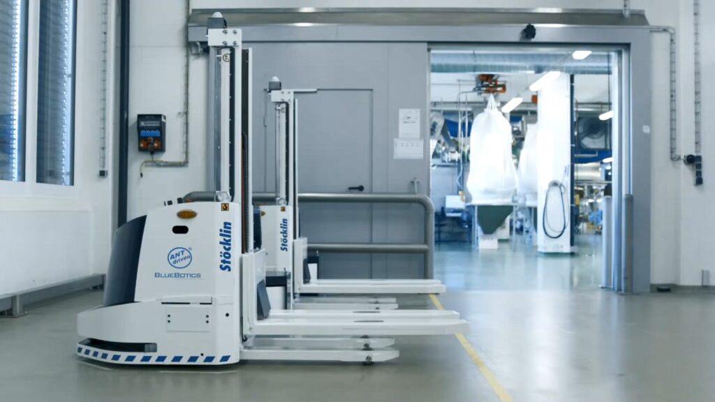
There is a boom in the use of automated guided vehicles (AGVs). Research from Grand View Research predicts that the global market will reach USD $9.1 billion by 2027. As many operations managers consider the benefits of AGVs, they face two fundamental questions: what type of AGV best fits my operation (e.g. pallet jack, tugger, forklift etc.) and what type of AGV navigation methodology should I utilize?
There are numerous technologies available in the market for guiding an AGV around a facility. Making the wrong choice of navigation system at the outset can have a dramatic effect on the cost and efficiency of the solution. However, selecting the optimum solution can be a complex challenge.
Grégoire Terrien, the VP of Development at BlueBotics, explains the different navigation options available.
Line following
Line following vehicles utilize magnetic tape, inductive wire, or painted lines to guide the AGV. The vehicle has a sensor that looks down at the line on the floor. It measures the left and right error and then uses this information to correct the vehicle’s trajectory. It is a simple approach that is ideal for applications in which a vehicle moves continually around a loop. An example is automotive manufacturing, where automated vehicles move parts from station to station.
Although a simple and precise technology, line following has drawbacks. First, it takes time to lay out or modify routes (especially in the case of inductive wire, which is literally installed in the floor itself), and the lines themselves can require regular maintenance. If fleet management is needed it can quickly become complex, especially when many lines are crossing each other. Traffic management can potentially become difficult for complex installations. Line following is, however, exceptionally reliable, accurate, and stable.
Tags
Within the broad category of tags there are a myriad of technologies such as QR codes, RFID tags, and magnetic points that are embedded directly in the floor. The vehicle is equipped with a specific sensor to follow a route defined by these tags. In that sense it is like line following. A common use is within eCommerce, where simple path layouts are the norm.
The pros and cons of tag navigation are similar to those for line following technologies.It is exceptionally reliable and robust in operation, but modification may be neccessary. Maintenance should also be expected over time.
Laser triangulation
The working principle of laser triangulation is similar to GPS navigation, in that it uses a minimum of three references to triangulate the position of the vehicle. Unlike GPS however, which uses satellites, this methodology utilizes a laser scanner that sits on top of the vehicle. Its beams are reflected off reflective targets that are installed in the environment. Unlike line followings and tags, where the logic of the mission is described by what is on the floor, with triangulation the logic must be programmed using software. This solution therefore requires dedicated software tools to make programming AGV missions easy.
Laser triangulation technology is exceptionally reliable. Accuracy is good, and relatively fast vehicle speeds are possible. As this technology uses virtual paths instead of the physical ones, maintenance costs are lower. Effective fleet and traffic management are much easier than with line following and tags. Route modifications are also quick and simple, unless significant changes require the installation of additional on-site reflectors. One of the drawbacks, though, is that laser triangulation systems can take a lot of time to design and install.
Another disadvantage is that the LiDAR scanners used for vehicle positioning often need to be mounted high on the vehicle to recognize reflectors and avoid humans or moveable objects that might hide these references. This additional component increases vehicle cost and effectively constrains buyers to certain types of vehicle, since there is nowhere to place such an extra sensor on an automated guided cart (AGC) or ‘mouse’ AGV.
Vision guidance.
Vision guidance is like how humans look at the world. It uses cameras in place of our eyes to recognize features in the environment. These are then compared to a 3D map, allowing the vehicle to calculate its position and navigate.
The installation of vision guidance AGVs is quite simple and quick, as vision guidance does not require any alterations to the existing infrastructure. The user simply drives the vehicle along the route, continuously collecting images all the while, in order to learn the path and construct the 3D map. The time and cost of maintaining a vision-based system are also low, as changing routes just requires an operator to re-teach the vehicle, driving it manually around the new routes required.
However, this technology suffers from the usual drawbacks associated with vision: changes in lighting conditions, such as glare or darkness, can impact the system’s accuracy, as can camera or image resolution, and changes in the environment can also have the same effect.
Natural feature navigation
Natural feature navigation uses laser scanners such as a vehicle’s built-in safety scanners. It compares the current 2D scanned image to a map, created previously, to calculate the vehicle’s position.
Natural feature navigation technology typically uses one of two methodologies: either a so-called ‘scan matching’ or a ‘feature matching’ approach. With scan matching, the raw laser data gathered is compared to the original map and this map is updated if new objects are detected. This approach requires the scan to be high quality (no deformation for example) in order to match correctly. The type of map used – grid based with low cell resolution – also affects this positioning accuracy.
By contrast, with feature matching, a relatively small number of natural, permanent environmental features – such as walls, columns and permanently installed machinery – are used as references to localize the vehicle. This method is highly robust as it requires few references to ensure accurate localization. And as the map never changes – unless required by a major infrastructure change – accuracy is retained over time. With this system there is no need for inductive wires, magnets, or reflectors for triangulation. As a result, setups are simple and economical to both install and maintain, whether a single automated guided vehicle or a large fleet of AGVs.
Similar to vision guidance, natural feature technology is simple to install because it requires minimal infrastructure changes. At most, a few reflective stickers might be needed. Similar to laser triangulation, natural feature navigation employs dedicated software tools that are used to program a vehicle’s routes and actions during installation. As natural feature is still a relatively recent navigation approach, most suppliers do not yet offer advanced or intuitive software tools, which can make installation a prolonged process.
Scan matching-based natural feature navigation is often based on frameworks such as the open-source Robotic Operating System (ROS), which is a great system to start with but requires high investment to industrialize.
There can be problems, however, for this type of natural feature navigation when slight changes occur to the environment, as it needs to identify at least 60% of the environment to calculate the vehicle’s position. If the environment changes, the accuracy can be affected, and the overall reliability of the system could drop. Much like laser triangulation systems, many scan matching suppliers install the laser higher on the vehicle, which can add to the cost and restrict the types of vehicles available.
Modifying operations with natural feature navigation is a quick and efficient process, since paths are virtual and there are no time-consuming infrastructure changes required. Fleet management functionality is widely available. However, since many natural feature suppliers are new to the market, advanced fleet solutions remain few and far between.
The best of both worlds
Unlike other natural feature technologies, ANT® by BlueBotics uses a feature-matching approach. The map it uses for vehicle localization is based on features rather than scan-matching’s grid-based map — meaning features are compared to features, rather than laser points to laser points.
Like other natural feature solutions, ANT® is simple and quick to install, with minimal infrastructure changes required. Since paths are virtual, the maintenance and modification of routes is also fast and cost-effective. ANT® offers similar accuracy and reliability as the most established triangulation technologies. Given BlueBotics’ 20 years of experience in the industrial AGV market, in contrast to other natural feature offerings, ANT® is a notably more mature product. In addition, because ANT® maps are feature-based and not grid-based, they are exceptionally light in terms of file size and much easier for companies to handle.
When it comes to managing fleets of AGVs, BlueBotics’ ANT® server fleet management platform makes creating and managing vehicle missions straightforward, including traffic management. Uniquely, ANT® server is also vehicle-independent, meaning ANT® driven vehicles from different brands can work together seamlessly, effectively widening a user’s choice of vehicle types.
In summary, the first generation of AGV navigation technology was physical: line following and tags. These technologies are reliable and accurate, but costly to install, maintain, and modify. Then came the first revolution: laser triangulation. This transitioned physical routes to virtual ones, reducing the cost of route maintenance and modification, while vastly improving fleet management functionality.
More recently, laser-based natural feature and vision guidance came to the market. These reduced the cost of installation, which had been a barrier to the adoption of AGVs. Unfortunately, with these benefits of simple installation came a trade-off in terms of accuracy, reliability, and robustness.
In our view, ANT® fits between laser triangulation and natural navigation (sometimes referred to as SLAM navigation) in the marketplace. ANT® offers vehicle makers and operators the best of both worlds: the speed and flexibility of natural feature navigation with the triangulation-like maturity and functionality of a solution that has been in the market for several years.
The Path to Navigation Success
Nine important considerations when assessing AGV navigation systems:
- Cost of infrastructure. The expected cost of changes to a site’s infrastructure, for example, installing laser triangulation reflectors, tags or inductive wire throughout.
- Vehicle installation time. The total time taken to commission one or more vehicles on site. The longer it takes to make the vehicle operation work, of course, the higher also the installation costs.
- Accuracy. This refers to the accuracy of a vehicle’s positioning, for example, when docking to recharge batteries or pick up pallets. ±1 cm / ±1° is a common requirement and very achievable with natural feature navigation.
- How long a navigation system can typically operate without error and therefore, the need for human intervention. In other words, this factor reflects how mature a technology is.
- Robust versus environmental change. If the environment changes, for instance, pallets or the objects move, how capable is the navigation technology of continuing to operate effectively without, for example, AGVs losing accuracy?
- Vehicle speed. How quickly can an AGV travel safely on its mission?
- Cost of maintenance. The cost of any maintenance excluding the maintenance of the vehicle itself. For example, ensuring the laser reflectors used for triangulation are not broken, or replacing tags or tape that ripped up over time.
- Cost of modification. Similar to the cost of installation. This is based on how long it takes to change a vehicle’s route. This modification might be purely digital, i.e. software-based, or involve instead the physical updating of tags, tape, or reflectors. An important consideration here is not only the change themselves but the retesting required afterward.
- Fleet management. How effectively can the system handle fleets of different sizes?